
- Details
Outdoor Recreation USA
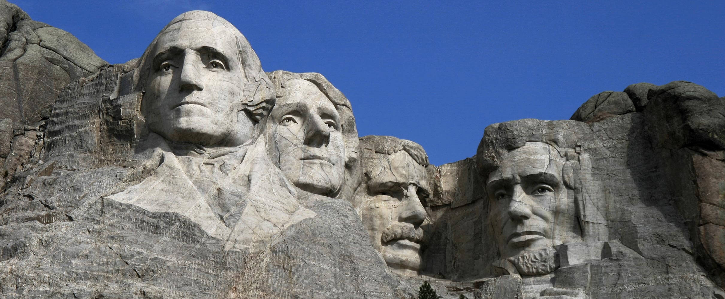
Explore the vast and diverse country of the United States, located in North America and bordered by Canada to the north and Mexico to the south. With its breathtaking landscapes, from the Rocky Mountains to the Great Plains to the coastal beaches of California and Florida, the United States is a place of wonder and cultural significance.Across the U.S. map, discover iconic landmarks like the Statue of Liberty and the Golden Gate Bridge, and experience the unique cities and cultures that make up this great nation. And experience United States maps with major cities, including the capital of the U.S.: Washington, D.C., which is a city with a rich history and a symbol of democracy worldwide.
EXPLORING THE US BY REGION
New England Region:
(Connecticut, Maine, Massachusetts, New Hampshire, Rhode Island, Vermont)
Home to gabled churches, rustic antiques, and steeped in American history, New England offers beaches, spectacular seafood, rugged mountains, frequent winter snows, and some of the nation's oldest cities, in a territory small enough to tour (hastily) in a week.
Mid-Atlantic Region:
(Delaware, Maryland, New Jersey, New York, Pennsylvania, Washington, D.C.)
The Mid-Atlantic is home to some of the nation's most densely populated cities (notably New York City), its most historically significant sites, rolling mountains, and seaside resorts.
South Region
(Alabama, Arkansas, Georgia, Kentucky, Louisiana, Mississippi, North Carolina, South Carolina, Tennessee, Virginia, West Virginia)
The South is celebrated for its hospitality, down-home cooking, and its blues, jazz, rock 'n' roll, bluegrass, and country music traditions. This lush, largely subtropical region includes cool, verdant mountains, plantations, and vast cypress swamps.
Florida Region
Northern Florida is similar to the rest of the South, but this is not so in the resorts of Orlando, tropical Caribbean-influenced Miami, the Everglades, and 1,200 mi (1,900 km) of sandy beaches.
Midwest Region
(Illinois, Indiana, Iowa, Michigan, Minnesota, Missouri, Ohio, Wisconsin)
A region of hospitable people, farmland, forests, picturesque towns, industrial cities, and the Great Lakes – the largest system of freshwater lakes in the world, which forms the North Coast of the U.S.
Texas Region
The second biggest state is like a separate country, with strong cultural influences from its Spanish and Mexican past. The terrain is quite varied, with swamplands in the southeast, flat land and cotton farms in the South Plains, sandy beaches in South Texas and mountains and deserts in far West Texas.
Great Plains Region
(North Dakota, South Dakota, Nebraska, Kansas, Oklahoma)
A former Wild West frontier land, the Great Plains region is full of large grasslands, badlands, valleys, dune fields, bluffs, and small mountains. Farmland is a common sight with towns, cities, and a few notable destinations like Deadwood, the Wichita Hills, the Little Jerusalem Badlands of Kansas, and Theodore Roosevelt National Park. The region is known for steppe wildlife (pronghorn, prairie dogs, and bison), as well as epic weather and spring-time storm chasing tours.
Rocky Mountains Region
(Colorado, Idaho, Montana, Wyoming)
The spectacular snow-covered Rockies offer hiking, rafting, excellent skiing, deserts, and a few cities and world-famous resorts.
Southwest Region
(Arizona, Nevada, New Mexico, Utah)
Heavily influenced by Spanish, Mexican, and Native American cultures, this area is home to some of the nation's most spectacular natural attractions, spa retreats, resorts, and flourishing artistic communities.
California Region
Like the Southwest, California is heavily influenced by its former Spanish and Mexican rulers, and also by Asian culture and cuisine. California offers world-famous cities, deserts, rainforests, snowy mountains, and beautiful beaches.
Pacific Northwest Region
(Washington, Oregon)
The pleasantly mild Pacific Northwest offers outdoor pursuits and cosmopolitan cities. The terrain features spectacular rainforests, scenic mountains and volcanoes, beautiful coastlines, and sage-covered steppes and deserts.
Alaska Region
One fifth as large as the rest of the United States, Alaska reaches well into the Arctic, and features mountainous wilderness, including North America's tallest mountain, Denali, and Alaska Native culture unseen elsewhere in the U.S.
Hawaii
A volcanic archipelago in the tropical Pacific, with influences from its indigenous Polynesian people and large Asian-American communities, laid-back Hawaii is a great place for a vacation.
- Details
Outdoor Recreation Utah
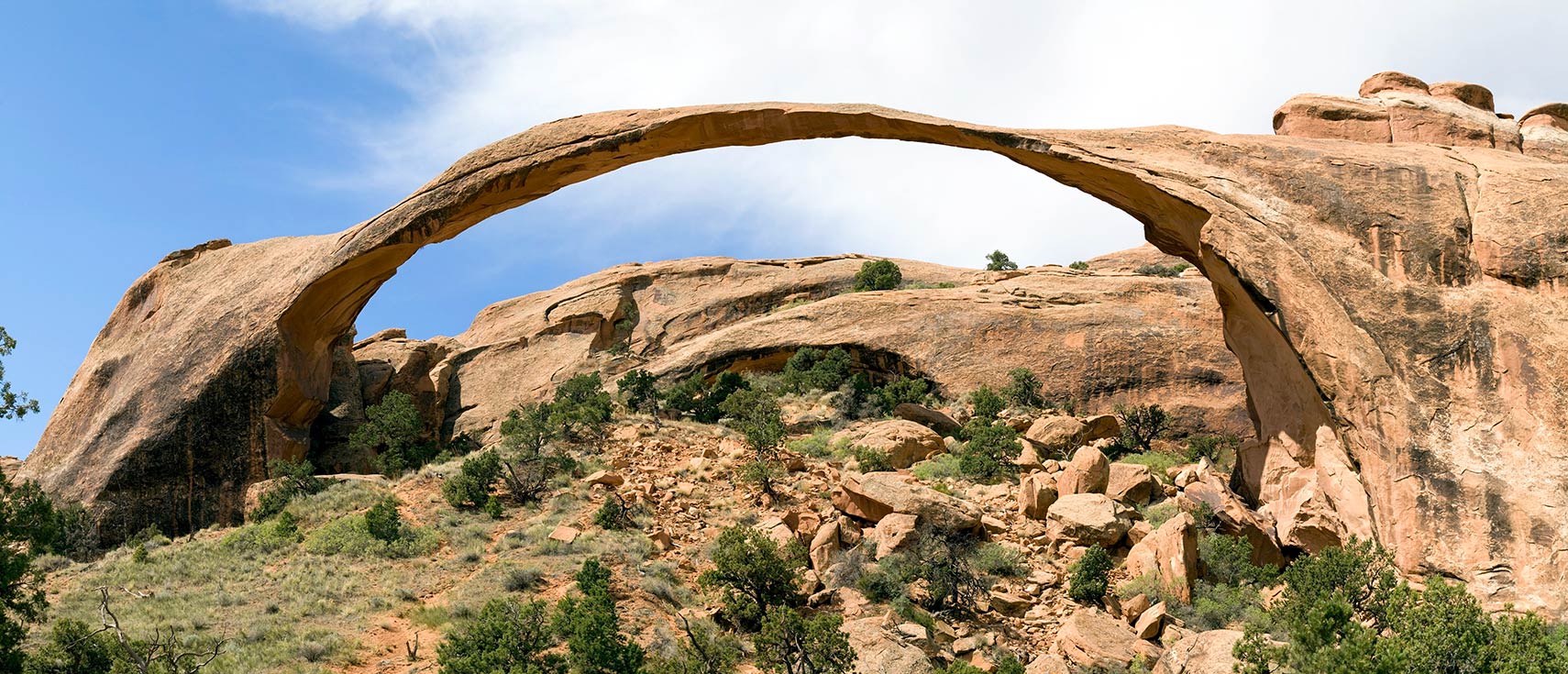
Utah is all about outdoor recreation and is known for many amazing outdoor activities. If you're seeking a weekend of hiking or backpacking, Utah has countless options. For starters, one could spend years exploring all of the nooks and crannies of just one of the five national parks, 44 state parks, nine national monuments, five national forests and two national recreation areas. 22.8 million acres of public lands, make up almost 42 percent of Utah outdoors. These lands range from snowcapped mountains of remote mountain ranges to wild rivers and colorful red rock canyons.
Where in the United States is Utah?
Utah is one of the 50 US states located in the western United States. The landlocked state borders Idaho and Wyoming in the north, Colorado in the east, Arizona in the south, Nevada in the west, and New Mexico at a single point at the Four Corners Monument. The region that is today Utah became part of Mexico in 1821 and was ceded to the US in 1848. Utah became the 45th state of the US in 1896.Some GeographyUtah covers an area of 219,882 km² of (84,897 sq mi), compared it is somewhat smaller than the island of Great Britain (229,848 km²) or about half the size of Iraq. Compared with other US states, Utah would fit into Texas more than three times.
Lakes of Utah
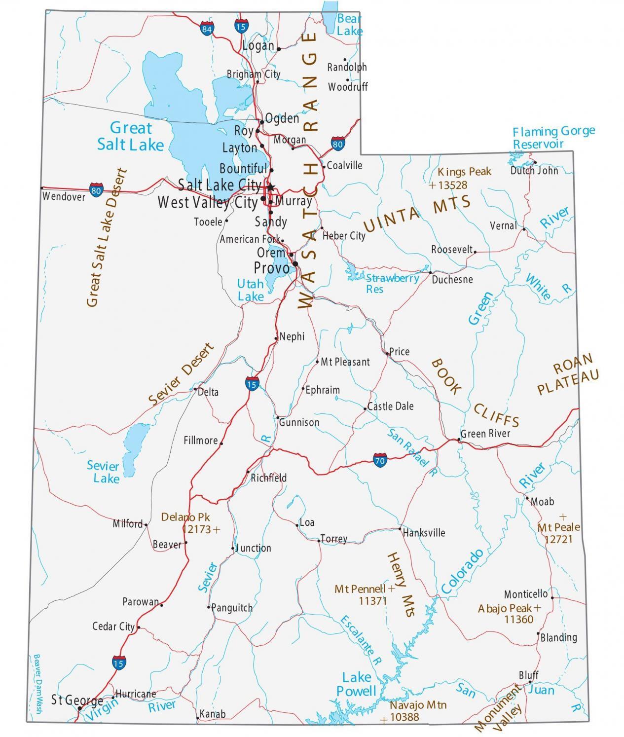
Major geographical features of the Beehive State (its nickname) are the Great Salt Lake Desert, a desert formed by a large dry lake (paleolake) between the Great Salt Lake and the Nevada border, east of Salt Lake City. The evaporated lake was once part of Lake Bonneville, a prehistoric pluvial lake that covered much of the eastern part of North America's Great Basin region.The Great Salt Lake, the largest saltwater lake in the Western Hemisphere, is also a remnant of Lake Bonneville.Utah Lake south of Salt Lake City and west of the Wasatch Mountain Range is a shallow freshwater lake with only one river outlet, the Jordan River.Sevier Lake in the Sevier Desert is fed by the Beaver and Sevier rivers.Lake Powell is a reservoir on the Colorado River in southern Utah and northern Arizona. Its water is used to retain and supply water to several western United States.
Rivers in Utah
- The Colorado is one of the principal rivers of the Southwestern United States.
- The Green River in the western part of the country is a chief tributary of the Colorado River.
- The Bear River is the largest tributary of the Great Salt Lake; it drains the mountainous area and valleys northeast of the lake.
- The San Juan River in the southeastern corner of Utah is another major tributary of the Colorado River; it defines the northern border of the Navajo Reservation.
- The Sevier River is the longest river 449 km (279 mi) entirely in Utah; it feeds the Sevier Lake, the rivers water is used extensively for irrigation and consequently Sevier Lake is now mostly dry.
- The 388 km (241 mi) long Dolores River drains an arid region of the Colorado Plateau in Colorado before it flows into the Colorado River.
- Blacks Fork is a 282 km long (175 mi) tributary of the Green River.
- The White River is also a tributary of the Green River.
- The Virgin River, a 261 km (162 mi) long tributary of the Colorado, was designated Utah's first wild and scenic river.
- The Price River has its source in the Wasatch Range, it flows then southeastward through Price Canyon and empties into the Green River.
Mountains of Utah
- The Wasatch Range is a 430 km (270 mi) long mountain chain running from the Utah-Idaho border south through central Utah. The highest peak in the Wasatch is Mount Nebo at an elevation of 3,636 m (11,928 ft).
- In Utah's southeast near the city of Moab, along the Utah/Colorado border, there is the La Sal Range with its highest elevation at Mount Peale (3,877 m or 12,721 ft).
- The Henry Mountains is in the southeastern portion of Utah, the highest peak is Mount Ellen at 3,512 m (11,522 ft).
The Navajo Mountain on the Utah/Arizona border is the highest point in the Navajo Nation. - The state's highest point is Kings Peak within the Uinta Mountains in northeastern Utah, reaching 4,123 m (13,528 ft).
National Parks of Utah
- Arches National Park has some 2,000 natural sandstone arches.
- Bryce Canyon features hundreds of multicolored sandstone hoodoos (fairy chimney) created by erosion (or a stoned god).
- Canyonlands is a maze of canyons, mesas, and buttes shaped the waters of the Colorado River, the Green River, and their tributaries.
- Capitol Reef, desert landscape with picturesque geologic landforms and rock formations in south-central Utah, facilitates scenic hiking.
- The Zion National Park, with its famous Zion Canyon, is a deep and narrow gorge carved by the North Fork of the Virgin River.
- Monument Valley Navajo Tribal Park is the Navajo Nation equivalent to a national park. Monument Valley is world-famous for its isolated colossal shafts and buttes of rock. The Valley lies mostly in northern Arizona, but the highway turn-off that leads into it is across the border in Utah.
Food and Drink in Utah
The food scene in Utah is one of a kind because of how closely it is tied to the state’s history and its local cuisine. Recipes tend to show the mark of early settler impact, especially Mormon pioneers who used comforting, hearty recipes that were passed down through generations and adapted. Iconic foods such as fry sauce, funeral potatoes, and Jell-O salads highlight this tradition. Utah’s natural resources also shape the state’s culinary identity, where honey, trout, and even local vegetables are staples of the cuisine. There is also an expanding modern food movement in the state, which fuses traditional flavors with more progressive takes, crafting a distinctive food culture that caters to many different tastes.
- Details
ALABAMA OUTDOOR RECREATION 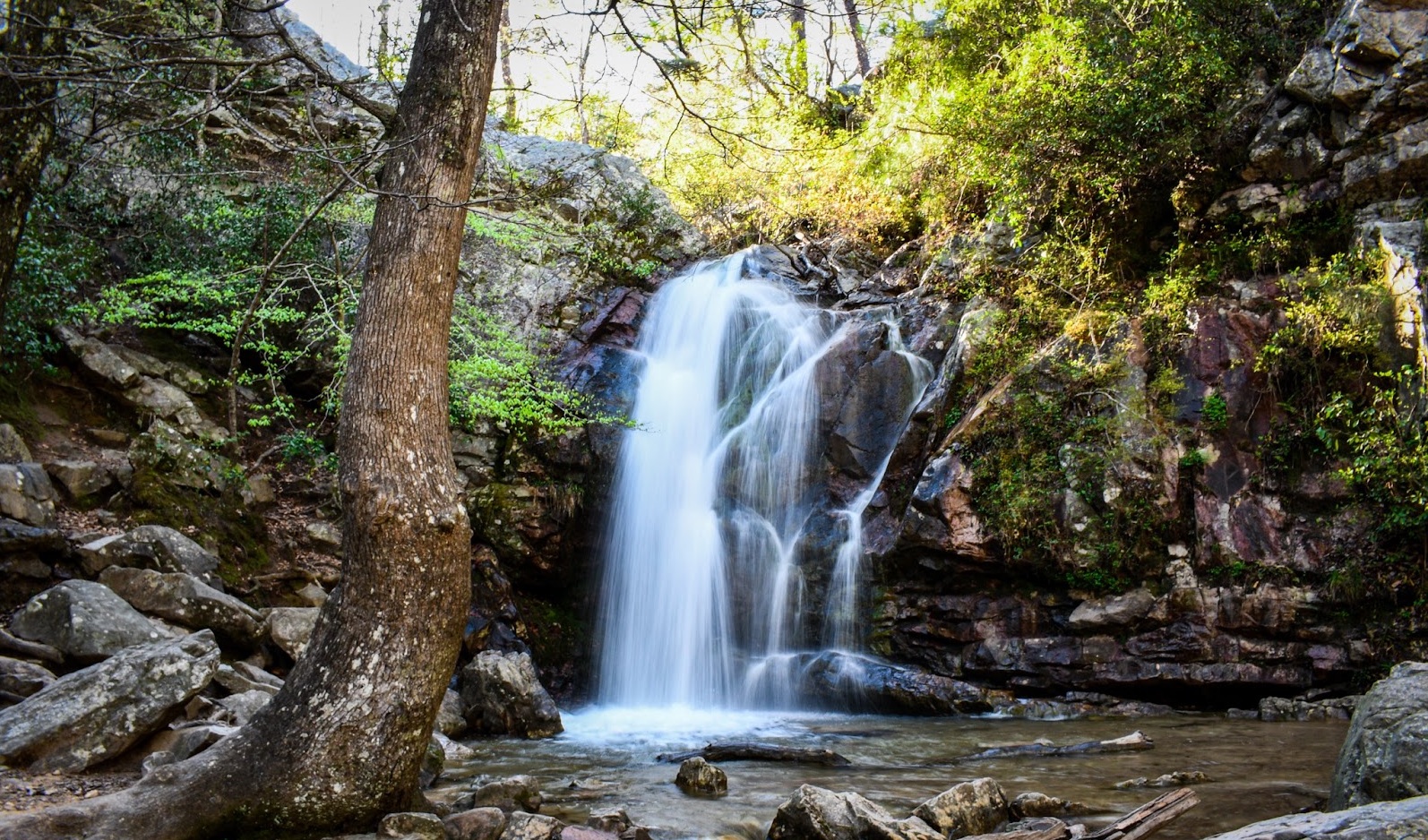
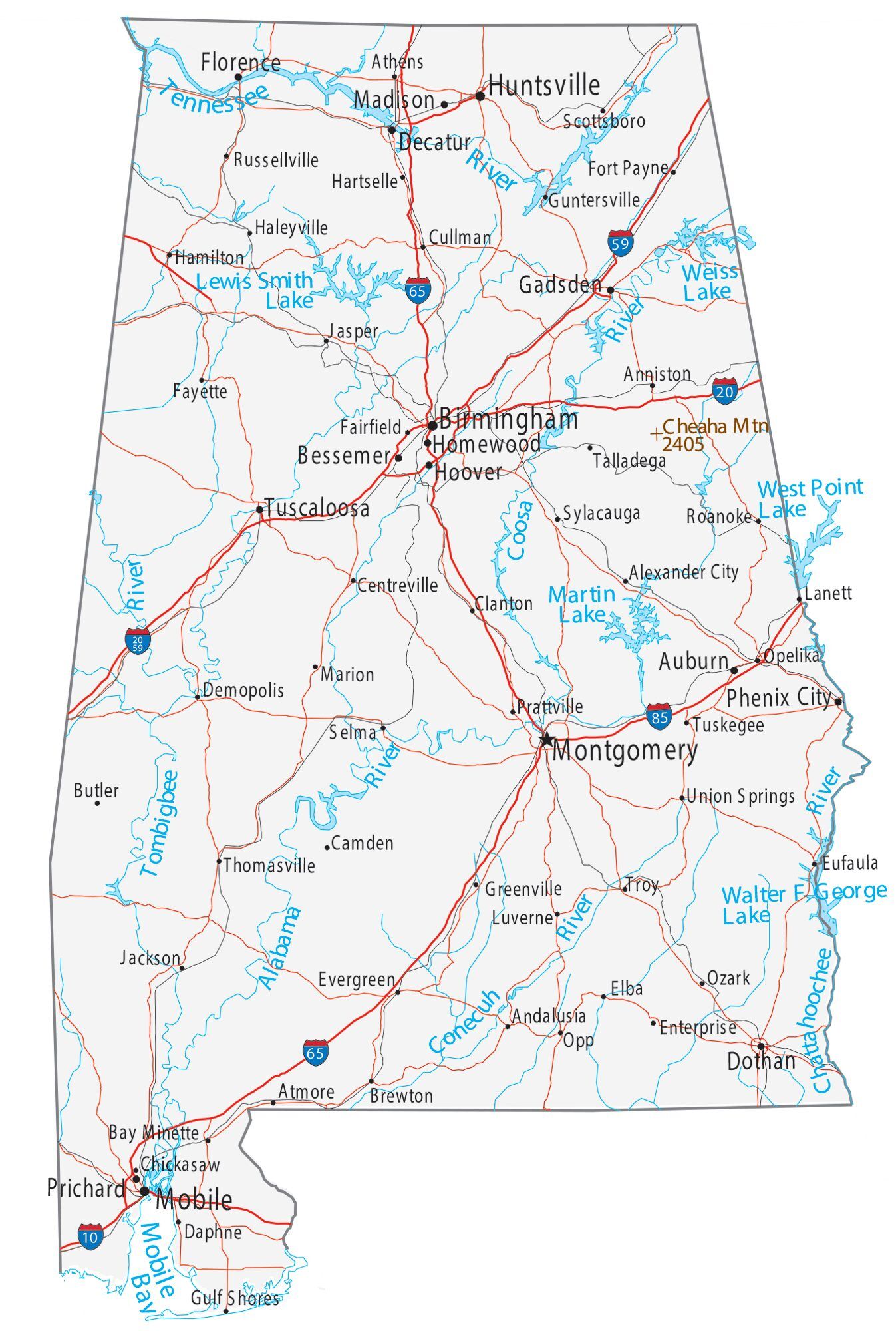
Alabama is one of the 48 continental U.S. states, located in the Southeast between Mississippi and Georgia. The state stretches from the Appalachian Mountains in the north to fertile valleys, pine forests, and sandy beaches along the Gulf of Mexico. It borders Tennessee along the 35th parallel north and Florida to the south, with a small coastal lobe opening onto the Gulf.For thousands of years, Indigenous peoples lived along Alabama's rivers. The first Europeans to explore the area were Spanish expeditions in the mid-16th century. About 150 years later, French settlers founded Old Mobile (Fort Louis de la Louisiane), the first European settlement. The region passed to Britain in 1763, to the United States in 1783, and on December 14, 1819, Alabama became the 22nd state of the Union.
BEST TIME TO VISIT ALABAMA
Alabama's climate is humid subtropical, with long, hot, and humid summers and mild winters. Rainfall is abundant year-round, heaviest in the south, and the state is known for severe weather, including frequent spring thunderstorms and tornadoes as well as the risk of hurricanes along the Gulf Coast. Tornadoes can occur in the region any time of year, but the primary tornado season is from March through May.
GETTING AROUND IN ALABAMA
Alabama's landscape is geographically diverse, encompassing coastal plains, rolling hills, and forested areas. Along its southern Gulf Coast, there are sandy beaches and marshy wetlands. Inland, the terrain rises into gently rolling hills, and the northern part of the state is characterized by the foothills of the Appalachian Mountains. These diverse landscapes offer a range of outdoor opportunities, from water activities along the coast to hiking and exploration in the wooded hills. The state occupies an area of 135,767 km² (52,420 sq mi), making it somewhat larger than Greece (131,957 km²). Compared with other US states by area, Alabama is six times larger than New Jersey, but it would fit into Texas about five times. Nearly 70% of Alabama's landscape is covered by forest.
Alabama's landscape offers five major physiographic regions; all areas are sections of the far greater geographic regions of the Eastern and Southeastern United States:
I. The Highland Rim section in the northwest and north-central Alabama is the southern portion of the Appalachian Highlands.
II. To the southeast of the Highland Rim rises the dissected tableland of the Cumberland Plateau (aka Allegheny Plateau), the southern part of the Appalachian Plateau.
III. Further southeast stretches out the belt of the Appalachian Ridge and Valley, a region with ridges along valleys in between, like the Red Mountain ridge that separates the Jones Valley from the Shades Valley south of Birmingham (AL).
IV. Between the Ridge and Valley area and the Atlantic Seaboard fall line dominates the Piedmont Upland Alabama's landscape, a triangular shaped area with rolling hills in the central eastern part of the state.
V. The Coastal Plain province of Alabama is the largest geographic region (about 60%) in the state. It is a mostly flat region, but here and there, it offers some change in the landscape, rounded and eroded hills, cuestas, and Flatwoods; and the are the floodplains of the Alabama and Black Warrior rivers.
RIVERS IN ALABAMA
Principal rivers in Alabama are the Coosa River, which becomes the Alabama River, which is then fed by its tributaries, the Tallapoosa, and the Cahaba rivers.When the Tombigbee River joins the Alabama, the river changes its name again to Mobile River.The Tennessee River, the largest tributary of the Ohio River, crosses Alabama in north.The Chattahoochee River forms a section of Alabama's border with Georgia.The Black Warrior River empties the largest drainage area that lies entirely within Alabama.LakesMajor lakes are Lake Guntersville, a reservoir along the Tennessee River; it is Alabama's largest lake.Wheeler Lake, Alabama's second-largest lake, is a human-made lake along the Tennessee River.Walter F. George Lake (aka Lake Eufaula) is a reservoir formed on the Chattahoochee River along the state line between Alabama and Georgia.Lake Martin is a reservoir along the Tallapoosa River; Pickwick Lake is another reservoir along the Tennessee River, and Lewis Smith Lake, a barrier lake on the Sipsey Fork of the Black Warrior River.
HIGHEST POINT IN ALABAMA
In the northeastern corner of the state is the Sand Mountain, a sandstone plateau, part of the southern tip of the Appalachian mountain chain. The highest point in Alabama is Mount Cheaha at 735.5 m (2,413 ft), located in Cheaha State Park.
FOOD AND DRINK IN ALABAMA
Mobile is known for fresh Gulf seafood, oysters, shrimp, crab, and catfish, prepared in Creole and Lowcountry styles. The city’s signature dishes reflect French, Spanish, African-American, and Native cooking traditions layered over 300+ years. Gumbo is arguably Alabama’s most iconic dish, built on a French roux base, Native-taught file and okra, and Gulf seafood. It’s also the dish that best represents Mobile’s history, born from the collision and adaptation of multiple cultures.
- Details
Outdoor Recreation Virginia

Virginia is all about the history.
The land was inhabited for 12,000 years before the English debarked in 1607, and the first African slaves were brought here in 1619, starting a plantation system that led eventually to the Civil War. In the 1700s, Virginia was home to such historic statesmen as Washington, Jefferson, Mason, Madison, and Monroe. Today, Virginia is a state of preservation and pride—museums and historic homes are everywhere—that also revels in the present. The food, wine, and craft beer scenes are red hot, and Virginians love to dance and make merry. Slow down, take the back roads, and create some history of your own.
When’s the best time to go to Virginia?
Spring and fall are Virginia’s prime seasons: comfortable, colorful, and usually sunny. The hot, humid summer means long, warm nights, ideal for alfresco dining, dancing, and concerts. Stay cool at the state’s many beaches, rivers, lakes, and pools. Winter tends toward the cold and dry, and with tourist sites less crowded, it’s a great time to visit museums and get cozy with history. Virginia’s weather is notoriously fickle, though, and temperatures can vary wildly from day to day. Keep an eye on the forecast and layer accordingly.

How to get around Virginia
Virginia is most easily traveled by car. Interstate 95 brings East Coast travelers from the north and south. I-64 heads west from Norfolk through Richmond and Charlottesville, connecting at Staunton with I-81, which runs southwest the length of the state, from Winchester to Bristol. Both these routes are scenic, but Virginia also has wonderful back roads.You can also reach Virginia via Richmond, Norfolk, and Charlottesville airports, all of which are small and are uncrowded. Washington D.C.'s airports, Dulles and Reagan are also located in Virginia.Amtrak runs several trains daily through Richmond and to Norfolk, the southern terminus of Amtrak’s Northeast route from Boston. Trains from Charlottesville’s Union Station can take you to or from New Orleans, Chicago, New York, or Boston, though trains are a slower way to get around.
Can’t miss things to do in Virginia
Charlottesville’s must-see sites are Jeffersonian: the University of Virginia and Monticello.In Richmond, tour the state capitol, and spend some time contemplating the James River—perhaps from Historic Tredegar, Hollywood Cemetery, Maymont, or the Boathouse at Rocketts Landing. Devote a few hours to the stunning Virginia Museum of Fine Arts and neighboring Virginia Historical Society.Heading south on I-64, you can experience time travel at Colonial Williamsburg, the best large-scale historic site in the country, where restored and recreated buildings, costumed interpreters, and a beautiful, human-scale setting give a compelling sense of Virginia’s past.Outdoor lovers won’t want to miss a chance to explore Shenandoah National Park or portions of the Appalachian trail that pass through the state, while the beaches and wild horses at Chincoteague are a totally different experience.Wine lovers will enjoy Northern Virginia’s wine region, which is just west of Leesburg, Virginia (close to Dulles Airport and an easy day or weekend trip from Washington D.C.).
Food and drink to try in Virginia
Eat some seafood—blue crab, oysters, and fish from the Atlantic, Chesapeake, and the state’s dozens of rivers. Look for salty dry-cured ham (Smithfield is legendary), barbecue, biscuits, spoon bread, and chess pies. Williamsburg’s historic tavern restaurants offer time-honored Southern specialties and a fun immersion into the past. Virginia’s contemporary food scene is booming, as restaurants old and new reimagine the classics, often paired with bourbon-centric cocktails, local craft beers, and highly palatable Virginia wines.Culture in Virginia
“Virginia is for Lovers,” goes the slogan, and it’s true. The state offers something for everyone to love. Climb or ski a mountain, relax on a beach or at a spa, take in a show or game, enjoy city excitement or small-town tranquility, and immerse yourself in history, festivals, and the arts. It’s a great blend of urban and rural, with distinct geographic cultures. The Chesapeake Bay, Atlantic Ocean, and Blue Ridge Mountains invite exploration. You can check out the watermen’s world at Tangier Island, go underground at Grand Caverns, surf-cast at Virginia Beach, explore Civil War battlefields, or hike more than 100 miles of the Appalachian Trail. Museums, historic homes, and historical highway markers are everywhere. Virginians love music, horses, boats, and sports—especially college basketball and football—and they’re always up for a party, so keep an eye out for the many annual festivals.
Virginia For Families
In Charlottesville, both UVA and Monticello are family-friendly, with lots to learn and plenty of room to roam. Downtown, ice-skate year-round at the Main Street Arena or do some hands-on exploration at the Virginia Discovery Museum. You-pick farms like Carter Mountain Orchard make for great outings, and there are wonderful day hikes nearby. In Richmond, downtown Capitol Square and riverside Historic Tredegar let you delve into the past and also run around outside. Maymont, a former estate, is fun for all with a mansion to tour, gardens, a petting farm, a nature center, and hills for a picnic and play. The Science Museum of Virginia is impressive, the Lewis Ginter Botanical Garden is gorgeous, and active families will want to get out on the James River in kayaks, canoes, or inner tubes.
- Details
Outdoor Recreation Alaska

No one can appreciate the beauty of the north until they visit: It’s hard to imagine what it’s like to cruise into Seward by boat, to hike through Denali National Park, to stay up long past midnight watching the sun set, or never seeing the sun rise. Because Alaska is America’s largest state--and a huge swath of it is off the road system--you can’t see everything in just a few weeks. Start in Anchorage and explore the newly-renovated and ever-changing Anchorage Museum, then head to the secluded Kenai Fjords or magnificent Chugach National Forest, or down to Homer for one of the state’s best local food scenes. If there’s time, fly to Juneau or drive north to Fairbanks to hike atop a glacier, canoe along a misty river, or find a lodge and just relax.
Best time to visit Alaska
While most people will suggest you visit Alaska during the summer, the best time to visit really depends on what you want to do. Summertime is great for cruises and wildlife watching, but if you want to catch the Northern Lights, a trip between September and April is better. Read the full story.

How to get around Alaska
Most flights arrive at Ted Stevens International Airport in Anchorage, while cruises tend to dock in Seward on the Kenai peninsula. The best option to get around Southcentral Alaska or the sections of Interior Alaska that are on the road system is to rent a car or RV. If Southeast Alaska is your area of choice, travel by ferry or, as most visitors to the state do, cruise ship.
Can’t miss things to do in Alaska
Your Alaskan experience will depend hugely on the time of year you visit. Summer sees cyclists touring the Kenai Peninsula as bald eagles fly overhead, and, when necessary, stopping for moose; hikers trekking Juneau’s luminous, baby-blue Mendenhall Glacier; cruise ships exploring the awe-inspiring Tracy Arm Fjord; and kayakers pushing between unspoiled mountains surrounding Prince William Sound. But Alaska in winter is a whole other story. Then, you can fly down Alyeska’s gargantuan ski slopes, cozy up in a secluded lodge, watching the heavenly northern lights flicker outside your window, or adventure into the backcountry by helicopter or skis. Whether you rough it by the campfire or book a few nights in a comfortable, warm lodge, there are accommodations for every type of traveler.
Food and drink to try in Alaska
Alaska has long been known for its seafood but the state’s food reputation is growing. But the tourism-season traditional hearty Alaskan meals are still here too: with giant pancakes and cinammon rolls the size of your head. Plenty of coffee too. At breakfast, try the state’s famous gourmet reindeer sausages seasoned with white pepper and coriander, or crab cakes doused in creamy Benedict sauce. Get every sandwich on sourdough bread, a historic staple. For dinner, indulge in fresh Pacific fish, such as pan-seared cod, smoked salmon, or fresh halibut cheeks sprinkled with lemon and cilantro.
Culture in Alaska
Any thought of Alaska should start with the Native groups that were here long before America was even an idea. To truly understand Alaska, immerse yourself in Native culture at every turn. From touring what’s on view of the the massive art collection at the Anchorage Museum or the University of Fairbanks Museum of the North to watching traditional dances at the Alaska Native Heritage Center, or shopping for crafts made by the modern-day artists keeping Native arts alive, you can see how hard people are working to not only keep their cultures alive but help them thrive. Then take a dive into ways the cultures have changed with the arrival of Russians, Americans, and other groups. But there’s also just plenty of small town America culture here, always with a distinctly Alaskan twist.
Travel Tips
Alaska almost seems like two different states, split between summer and winter. Anchorage in July sees sunrise near 4:30 a.m. and sunset just before midnight, while winter daylight peeks out midday for a few hours. Up north in Fairbanks and beyond, those hours stretch with summer sun and winter dark sticking around seemingly nonstop. Winter temperatures hover around 5 degrees in Southcentral, though the inside passage around Juneau is significantly warmer at 20 degrees. Summer is warmer than most visitors believe, often in the mid-60s and quite green. Fairbanks? Even hotter.
If you plan on camping outdoors alone, basic survival skills and bear spray and canisters are crucial.